
 Our other Islands
 Green Island and Orchid Island are two hilly, volcanic islands located off the Pacific coast of Taiwan. Green Island is situated 33 km east of Taiwan proper and has an area of approximately 16 sq. km. The island is also home to one of the world’s three saltwater hot springs, Zhaori Hot Spring. Orchid Island, which is inhabited by the indigenous Yami people and lies several tens of kilometers to the south of Green Island, has an area of 46 sq. km, making it Taiwan’s second-largest offshore island after Penghu. Coral reefs and abundant sea life fringe the coastlines of both islands.
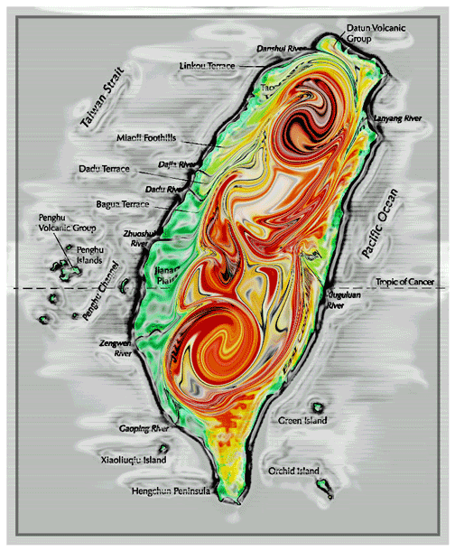
Sitting just off the southwest coast of Taiwan proper, Xiaoliuqiu is one of the largest coral islands in the world at 6.8 sq. km. The unique coral formations were created by eons of wind and rain erosion. Much of the coral is a brilliant crimson as it is composed primarily of iron and silicon oxides. Taiwan maintains a historical claim to four groups of islands scattered over a vast area in the South China Sea. The groups are: the Dongsha (Pratas) Islands, Nansha (Spratly) Islands, Xisha (Paracel) Islands, and Zhongsha Islands (Macclesfield Bank). Currently, Taiwan’s effective jurisdiction includes the Dongsha Islands, and Taiping (Itu Aba) Island and Zhongzhou Reef of the Nansha Islands.
The Dongsha Islands are located about 444 km southwest of Kaohsiung and comprise Dongsha Island and two coral reefs. Dongsha Island is a coral atoll with a land area of 2.38 sq. km. In addition to being a source of fish and minerals, the islands are also used by Taiwan as a naval outpost, and a hospital, a power station, a satellite tracking station, and a runway have all been built on Dongsha Island.
The Nansha Islands consist of 180 islets, reefs, cays, and banks in an area extending 810 km from north to south and 900 km from east to west. Taiping Island, located 700 miles southwest of Kaohsiung, is the largest island in the group with an area of just 0.48 sq. km. The area has abundant fishing, mineral, and petroleum resources. The Nansha Islands have great strategic importance, and the Coast Guard Administration of the Executive Yuan stations personnel on Taiping Island.
Lying about 170 km northeast of Taiwan proper is the Diaoyutai Archipelago, a tiny island group that includes Diaoyutai Island, Huangwei Islet, and Chiwei Islet.
資料整理:
- 蘭嶼和綠島,丘陵地形之火山島嶼,外沿皆有豐富的珊瑚礁環抱生長。
- 小琉球,世界最大的珊瑚礁島嶼之一,6.8平方公里。
- 中華民國歷史上宣誓的南中國海四群島,東沙群島、南沙群島、西沙群島、中沙群島;現中華民國行政管轄有東沙群島、太平島、南沙群島之中州礁。
- 東沙群島,包含一個島嶼和兩個珊瑚礁,駐有海軍前哨、一個醫院、衛星站、機場跑道。
- 南沙群島,180個小嶼、礁、沙洲、濱。
- 太平島,是群島中最大的一個島嶼,其島嶼範圍是國內重要的漁場、有豐富的礦物資源、也有石油;同時也是重要的軍事指揮中心,有行政院海巡管理單位之人員佈署。
- 釣魚台列島。
極東 121度59分15秒 臺北縣貢寮鄉三貂角。
極南 021度53分50秒 屏東縣恆春鎮鵝鑾鼻。
極西 120度01分00秒 雲林縣口湖鄉外傘頂洲。
極北 025度18分20秒 臺北縣石門鄉富貴角。
澎湖群島、金門、馬祖。
The 2008 edition of the Republic of China Yearbook


No comments:
Post a Comment